Trier- Germany's oldest city.
Posted on Sep 20, 2013 in category
Ancient Trier enjoyed both a scenic and more importantly, strategic location at the junction of the mighty Moselle River and the smaller Altbach River which helped the city to control commerce coming from the Moselle/Rhine Rivers heading south towards Metz and Lyon. Occupied from pre-Roman times by the Treveri tribe, Trier initially became a Roman cavalry camp of Spanish auxiliaries under Augustus (circa. 30 B.C.) and shortly after circa. 16 B.C.-13 B.C., adopted the new name 'Augusta Treverorum'.
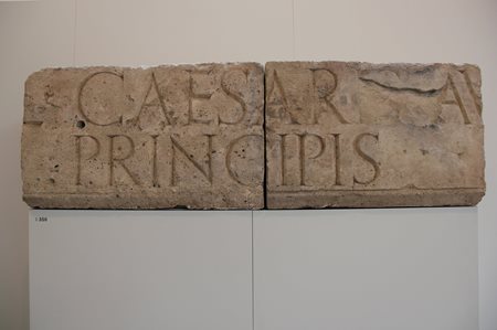
Evidence of loyalty to the Julio-Claudian principate: a memorial stone excavated in Trier with an inscription to the two adopted sons of Augustus, Gauis and Lucius, both of whom died young; thus, upsetting Augustus' plans for his succession (Trier Archaeological Museum).
In A.D. 41 Trier added the title 'Colonia' to its name after Emperor Claudius honoured it. A contemporary of Claudius, Pomponius Mela, described the city as 'Treveris urbs opulentissima', 'city of great wealth amongst the Treveri'. This statement by P. Mela reveals an amazingly rapid growth in the city's monumental architectural wealth. This rapid growth coincided with many other cities in Roman Gaul especially in the early Empire (G. Woolf 1998). In fact, Trier is a good example of what Woolf calls a social/economic phenomenon that resulted from a combination of a "cultural revolution" and a "consumer revolution". Goudineau (1980) estimated that Trier's population was between 20,000 - 30,000 people with most Gallo-Roman cities/towns averaging 5,000-6,000 people (Woolf 1998, p.137). However, P.S.Wells (2001, p.13)) is far more conservative estimating that no "great centre" like Trier was likely to have had more than 10,000 inhabitants.
Another measure of Trier's identification with, and wealth within, the Gallo-Roman regime is the amount of ornamental stone inscriptions found by archaeologists. Although restricted to the fact that most Gallo-Roman stone inscriptions belong to the 2nd/3rd centures A.D., Trier is still ranked 5th. in the 'Top 10'.
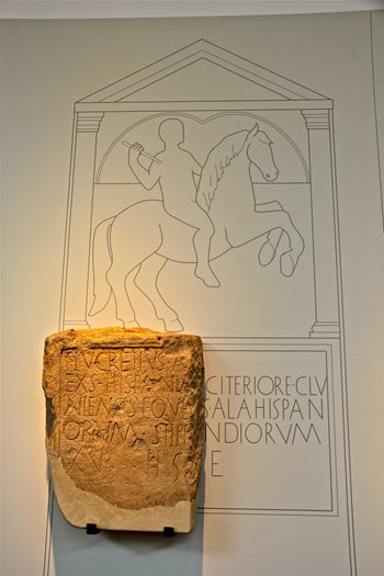
Titus Lucretius Sohn des A... served the Roman auxiliaries for 15 years in a cavalry 'ala'. Clunia commissioned this limestone memorial around AD 16-17.
Trier soon became a provincial administrative 'civitas' for Gallia Belgica and seat of the province's 'procurator' or tax collector. Its protective walls may have begun with encircling approximately 81 hectares but eventually expanding its perimeter to over 280 hectares by the 4th century AD; thus, becoming the largest 'civitas' in the western empire.
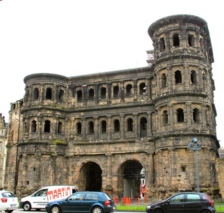
One of five city gates, the north-positioned 'Porta Nigra' (UNESCO World Heritage site) was part of the city's 6.4 kilometres wall built circa. AD 160-180.
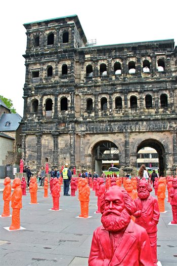
A rear view of 'Porta Nigra' that was strewn with a temporary art installation featuring statues of Karl Marx, who was born in Trier on 5 May 1818.
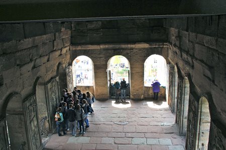
One of the galleries inside the 'Porta Nigra'. There are three floors to explore in one of the two towers. A Greek hermit monk, Simeon, lived in the eastern tower from AD 1028-1034/5. After his death, he gained sainthood resulting in the 'Porta Nigra' becoming a church and monastery. Napoleon dissolved the Christian Church and restored it to its main Roman architectural features.
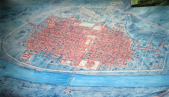
An artist's interpretation of Trier on the Moselle River in its heyday (4th century AD). The 'Porta Nigra' is no.4.
Another way to calculate Trier's population growth is to take a reasonable number of inhabitants per hectare, say 100 inhabitants per hectare (Woolf 2008, .137). Therefore, Trier by the end of the 1st century AD with its 81 hectares had a likely population around 8,100 people. By the end of the 4th century AD, based on this method, its massive 280 hectares site provided for a population of around 28,000 inhabitants. However, despite Trier's size and growing munificence, it was metaphorically speaking, still 'an island of Roman civilisation within a sea of Gallic villages' (Woolf 2008).
One of the ways that Trier's indigenous elite could show their 'romanitas' and 'humanitas' ( a way of life full of culture and based on good conduct) was to provide citizens with lively entertainment within magnificent venues. In the third quarter of the 1st century AD, the 'Barbarathermen' baths with its heated swimmimg pools was constructed followed in AD 100 by the amphitheatre for 20,000 spectators along with a documented 'hippodrome' or circus which may have rivalled Rome's Circus Maximus. Circuses were rare in Gaul, there are only four on record: Arles and Vienne with archaeological evidence but Lyon and Trier have only epigraphy and literary accounts as proof (P.J. Goodman, The Roman city and its Periphery 2007, p.148).
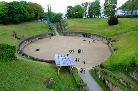
Visitors can venture into the maze of restored tunnels underneath the arena which measures 75 metres x 50 metres. They can appreciate a different dimension to the Roman Games or 'ludi'- religious festivals. Slaves worked beneath the arena handling the many animals to be slaughtered in a morning's beast spectacle. Gladiatorial events featured in the afternoon just after the midday slaughter of criminals. Interestingly, the auroch was an animal from Germania which was favoured in Rome. Pliny the Elder Nat. 8.15 mentions it along with a 'urus' from the Rhine Valley.
Both the Imperial Palace and the massive 'Kaiserthermen' or Constantinian Baths were built over many years from AD 289-340 but the latter was never fully functional as a public bathhouse..

The Imperial Baths was designed to allow 6 boiler rooms generating temperatures of 40 degrees celsius. There were 3 semi-circular pools in the design and an enormous palaestra (dark green foreground) for athletics and exercises.
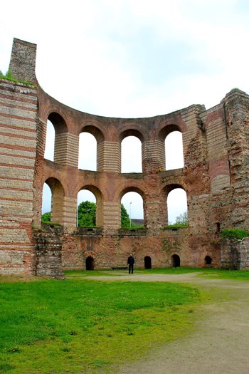
By standing in the middle of a partially reconstructed 'caldarium' or hot room, one can get a glimpse of the cultural superiority or 'humanitas' sought-after by Gallo-Romans.
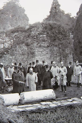
In 1913 Kaiser Wilhelm II visited Trier's 'Kaiserthermen'.
Emperor Constantine built his palace in Trier as headquarters for his Western Empire. Today only the restored, World Heritage Site called the 'basilika' or Audience Hall remains. Twice it has been restored as a Protestant Church, once by Frederick Wilhelm IV of Prussia and, in 1956 after its destruction during an Allied bombing raid on August 14, 1944.
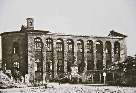
Only the shell of the basilika was left standing after an Allied incendiary bombing raid. It was recorded that the organ inside the basilika 'played' during the conflagration.
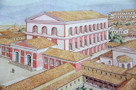
The basilika or Audience Hall in happier days when it was an important part of Emperor Constantine's palace.
All of this cultural and architectural wealth begs the question, how did this 'civitas' become so affluent?
Again, Pomponius Mela wrote, "This land is rich, above all in corn [cereral crops] and pastures [sheep, horses, pigs and cattle] and pleasant with great and sacred forests [timber]." Strabo, a Greek geographer writing in the early 1st century AD, commented on the region's productive agriculture such as "abounding in cattle". Extensive warehouses were built along the Moselle and the foundations of one of these 'horrea' was found within the north-west section of Trier's defensive wall that skirted the Moselle River. Because of the large size of these warehouses, some historians believe that they may have been State enterprises especially for storing grain (P.J. Goodman 2007, p.117).
Trier was also well known for its sigillata pottery, wine and woollen textiles. In a nearby village of Igel, the wealthy Secundinius family dedicated a 23 metres stone obelisk monument to the deceased members of their woollen textiles merchant family. On the memorial there are depictions of trade along the Moselle which reveal the importance of river commerce for Trier. The Moselle River linked Trier to Gaul's extensive river system.
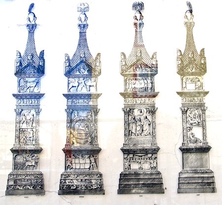
Restoration work is presently being carried out on the Igeler Saule; however, these drawings of the reliefs reveal some interesting cameos of the Secundinius family's life such as on the north side where a huge woollen bale is being moved into position by 5 men.
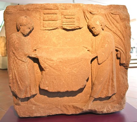
Another wealthy cloth merchant's memorial shows the family's pride in the quality of their merchandice (2nd-3rd centuries AD).
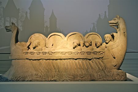
Although excavated at Neumagen, which is also situated on the Moselle, this sandstone memorial depicts a typical Moselle River scene in the 2nd century AD - merchants taking their wine stored in wooden barrels (a Gallic invention!) to a market.
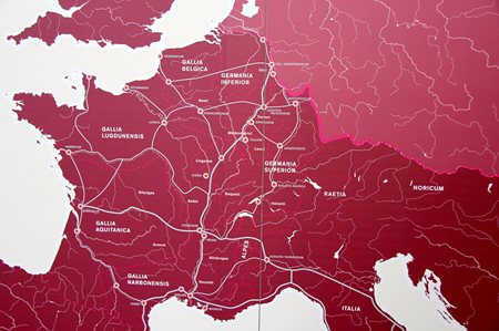
Another plus for Trier's transportation was its location on the Roman road system which was upgraded and expanded by Agrippa in 19-18 BC. Roads led to the Rhine River which would allow merchants from Trier to partake in supplying the Roman legions stationed along the limes or border forts. Roads also went south, north and west towards the rich civitates markets of Metz (Divodurum Mediomatricorum), Cologne (Col. Agrippinensium) and Reims (Durocortorum) respectively.
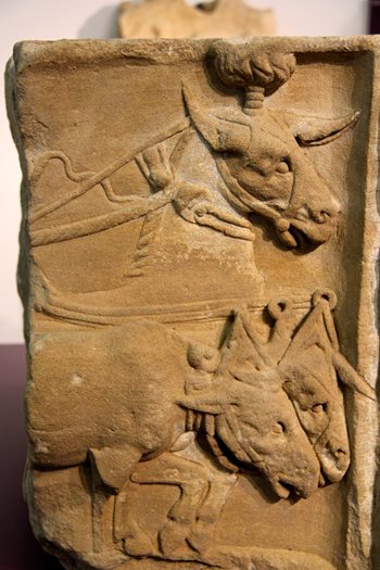
A horse and two mules pull the waggon of Trier merchant, Lucius Securius (AD 200).
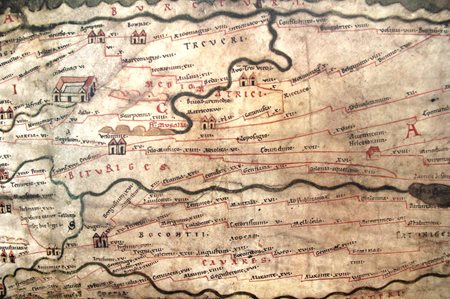
Trier is one of 555 vignette cities on the Tabula Peutingeriana, thought to be a 12th century medieval copy of a Roman tourist map, a type of Michelin Guide, circa AD 365.
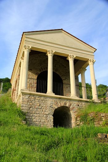
A reconstruction of a wealthy villa owner's tomb that was built overlooking the Moselle River near Trier (AD 2nd-3rd centuries). Burials took place on the ground floor and relatives had remembrance functions in the room above.
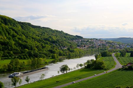
A great view from the Roman tomb showing that river commerce is still important for Trier's economy.